UAV Imaging
Team Members: Shen Yue, Yushi Wang, Yubing Xu
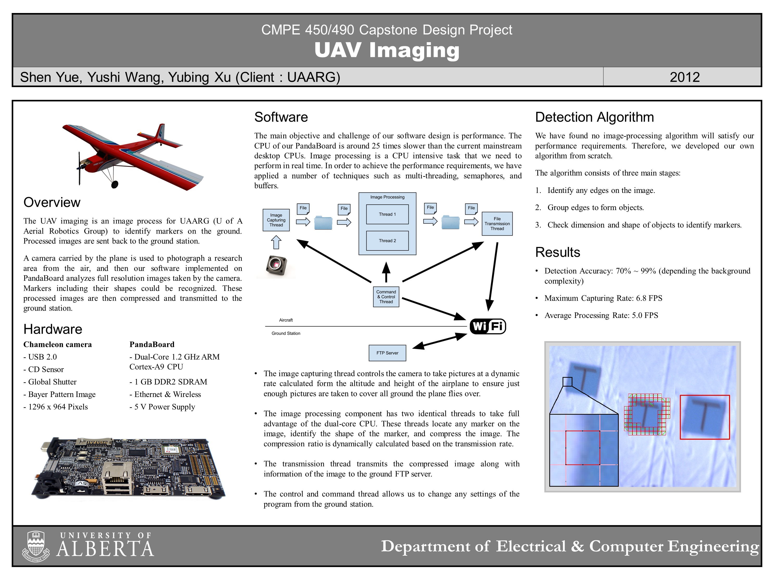
Client: UAARG The UAV imaging is an image process for UAARG (U of A Aerial Robotics Group) to identify markers on the ground. Processed images are sent back to the ground station. A camera carried by the plane is used to photograph a research area from the air, and then our software implemented on PandaBoard analyzes full resolution images taken by the camera. Markers including their shapes could be recognized. These processed images are then compressed and transmitted to the ground station.